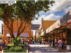
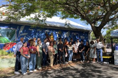
Coconut Grove residents had an opportunity to voice their concerns about traffic and street safety earlier this week at a forum hosted by University of Miami researchers.
Those who attended weren’t shy about expressing their views.
“I have a little baby and I think the streets in Coconut Grove can be safer than they are today,” said Prat Agarwal, who lives on Matilda Street in Center Grove. “We have lots of pedestrians here and there are lots of kids running around. If we can make the neighborhood safer for everyone, everybody benefits.”
Others who attended the forum voiced similar concerns.
“It’s a community with a lot of young families, elderly people, and walkers. It’s a walkable part of Miami, but at the same time it’s very dangerous from a traffic point of view. Those two clash,” said Karen Deeks, who lives on South Bayshore Drive.
“Where I live in the Grove, it’s completely unsafe crossing the road,” Deeks added. “The traffic has increased but people also speed and drive recklessly. Even the crosswalks and the lights they put in don’t help. People don’t stop.”
That was exactly the kind of feedback that organizers were hoping to hear at the WalkSafe and BikeSafe community forum, said Gillian Hotz, a research professor and neuroscientist who leads the University of Miami’s KiDZ Neuroscience Center.
“Our main goal is to make these communities safer, but to do that, we need to talk to the residents,” she told the Spotlight.
WalkSafe and BikeSafe are nonprofit programs at the University of Miami aimed at reducing pediatric brain and spinal cord injuries.
The twin programs, which are part of the neuroscience center, are perhaps best known locally for the pop-up bike lane that appears on Matilda Street during Walk, Bike & Roll to School Day and pop-up traffic calming at Frances S. Tucker K-8.
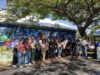
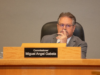
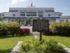
The recent pop-ups have been funded by the National Safety Council, which is also funding two Neighborhood Street Safety Feedback Forums. The first took place on Monday February 10 at the Virrick Park Library, where Hotz and her colleagues took suggestions from residents for three hours.
The forum focused on Little Bahamas and Central Grove. Residents who attended were given sticky notes to place on three maps, marking streets where they felt unsafe and adding suggestions to mitigate risks.
The three maps were bounded by South Dixie Highway on the north and the west, Southwest 27 Avenue and Main Highway on the east, and Hardee Road on the south.
The vast majority of sticky notes and markings concerned walkability – crosswalks and sidewalks were a top concern – and children’s safety, especially on Douglas Road.
The event organizers have held similar forums in other Miami-Dade communities, and they plan at least one more in Coconut Grove in the coming months, according to Kurt Kaminer, the safe streets and multimedia manager at the neuroscience center.
The feedback likely won’t result in immediate improvements, but will serve a larger purpose down the road, Kaminer said.
To that end, Kaminer said he plans to create a geographic information system (GIS) map that pins the feedback collected at the forums – the comments and suggestions submitted by participants – to specific locations on the map.
“We’re really putting together this data for the future,” Kaminer said. “Right now, traffic engineering doesn’t necessarily allow for what everybody wishes to see – car-free roads and safer streets – however, we’re moving in that direction.”
Kaminer’s plan and map could help to shape the decisions that traffic engineers make in the future. For now, however, residents are making sure their voices are heard.
“We wanted to share that Coconut Grove could be safer,” Agarwal said. “We wanted to put our words into action, so that the city is encouraged to make it safer for us.”